Mature Stage Convection
Now we’ll look at the situation at 1200 UTC when many of the convective systems are at their maximum intensity and reach their mature stage. View the animations, then answer the question below.
Question 1
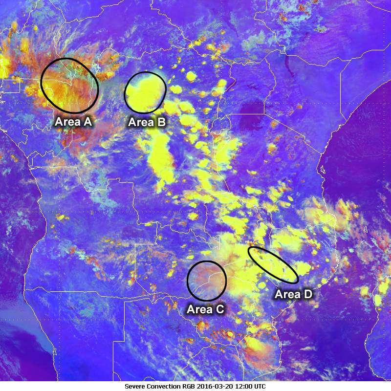
In which areas is the convection still developing rapidly?
The correct answers are B and D.
This will be explained in the next question.
Question 2
What information does each product provide for monitoring the development of the convection during the day?
The correct answers are B, D, E, and H.
The IR images provide a good overview of the extent of the convection, which clearly increases during the day, particularly after 11 UTC.
The coldest cloud tops in the enhanced IR images are below -80 degrees during the local afternoon hours after 11 UTC. Some of them show a cold ring (circular area of very cold cloud tops) at the top of the storm. This is a typical signature of intense convection.
Overshooting cloud tops cast shadows on the clouds, which can be seen in the HRV images. These are particularly evident over the DRC during the local afternoon. Since the HRV is a solar channel, it cannot be used to detect cloud top temperatures.
In the severe convection RGB, the expanding and brightening yellow areas indicate that the strong updrafts in the convection clouds are increasing during afternoon. The reddish colours are mostly seen for less developed convective areas as well as for older, large convective areas, such as those over the DRC.