Draw the ITCZ
Question
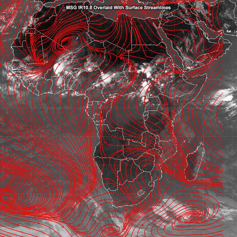
This IR 10.8 image is overlaid with NWP (ECMWF) 10-metre streamlines. Using the pen tool, draw the location of the ITCZ on the image, then click Done.

| Tool: | Tool Size: | Color: |
|---|---|---|
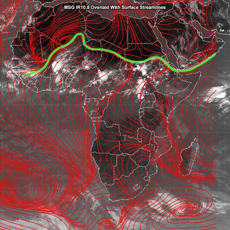
Generally, the ITCZ is the region where the north-easterly and south-easterly tradewinds converge. They form an often-continuous band of clouds or thunderstorms, or an elongated band of clouds several degrees across.
It can be challenging to identify the location of the ITCZ using IR images alone. Adding NWP model output, surface observations, or satellite winds from scatterometers makes it easier to identify the exact location where the winds converge.
In this IR 10.8 image, it's fairly easy to follow the zone that differentiates the hot, clear air in the north from the humid, cloudy air in the south over western Africa. The surface wind streamlines help us find the exact location of the ITCZ. The zone follows the confluent winds all the way across western Africa to the east. There's a distinct bulge towards the north over Niger and the southern parts of Algeria.
