Identifying the Tropical Low
This case shows the evolution of a tropical low into a tropical cyclone from 16 to 18 January 2013. View the animations in the tabs, looking for areas of clouds that are associated with the tropical low. Then answer the questions below.
Question 1
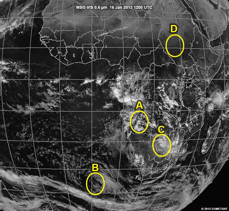
Which area has a tropical low?
The correct answer is C.
In this area, you can see the central vortex around which all the clouds are circulating. Area A is incorrect since there is no clear circulation in that region. Area B is found in the mid latitudes where tropical systems can not form due to the changes in wind speed and direction with height. Area D cannot be correct since there’s no cloud cover that would indicate the presence of an active low pressure system.
Question 2
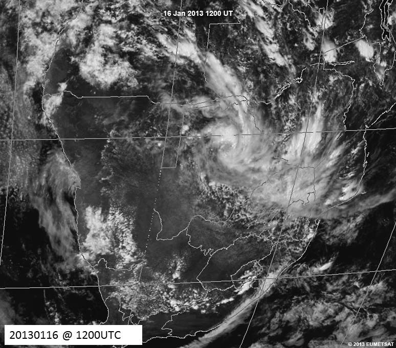
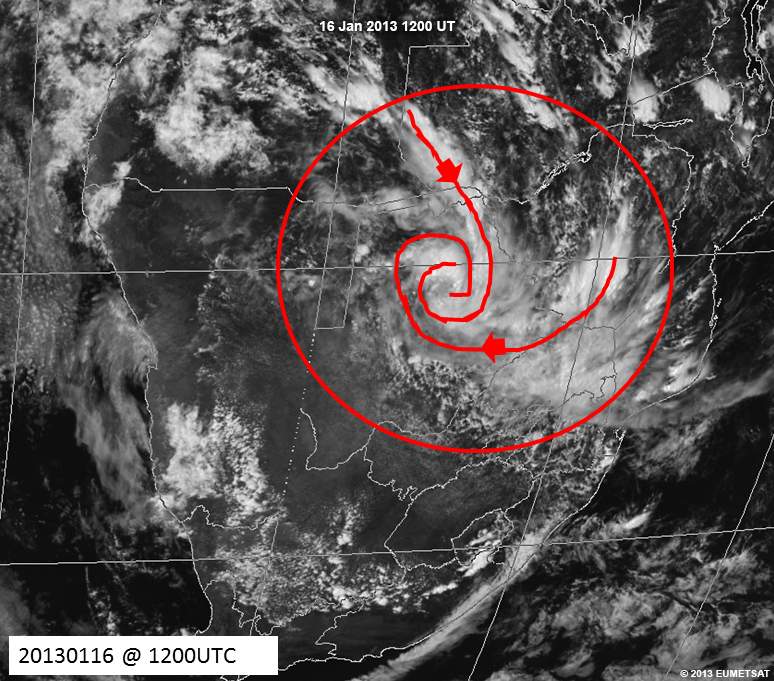
Use the drawing tool to outline the tropical low on the image.
| Tool: | Tool Size: | Color: |
|---|---|---|
The clouds within the tropical low cover the eastern parts of Botswana, northeastern parts of South Africa, and southern parts of Zimbabwe. The cyclonic rotation is easy to see in the image.