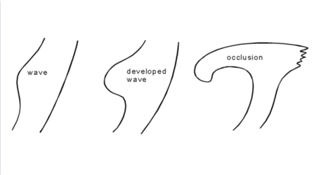
As already mentioned in the general remarks, the cloud band of the occlusion
described in this chapter is the result of a classical wave development
(compare
also chapter WAVE
![]() WA
WA
![]() )
represented by a growing multilayered cloud spiral.
)
represented by a growing multilayered cloud spiral.
|
|
|
|
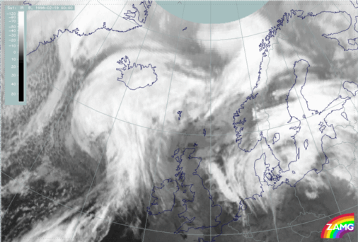
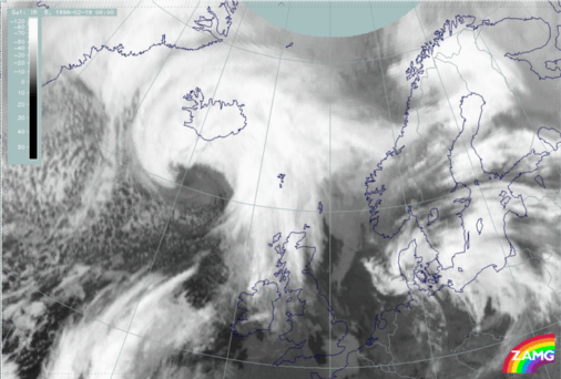
At 00 UTC a well-developed wave stage can be observed south of Iceland at
approximately 61°N/22°W with distinct dry air (black stripe in the WV
image) being involved in the circulation.
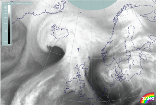
At 06 UTC an intensification of both the cloud spiral as well as the dry
intrusion can be noticed. The cellular structure immediately south of Iceland
at approximately 62°N/17°W indicates a potentially unstable
stratification within the troposphere.
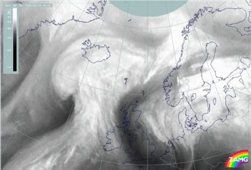
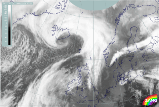
Left: 19 February 1998/12 UTC - IR image
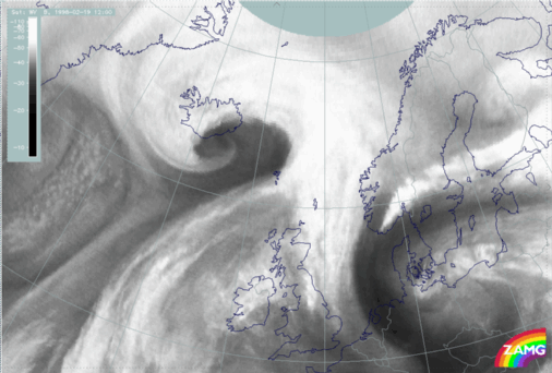
Right: 19 February 1998/12 UTC - WV image
|
|
|
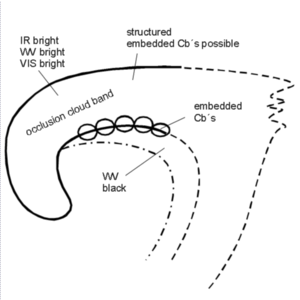
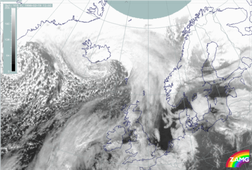
At 12 UTC this process has further developed where a lot of typical features
can be observed: a bright cloud spiral in all three channels, a structured
appearance in all three channels, decreasing cloud tops to the centre of the
spiral south to south-east of Iceland from approximately 62°N/18°W to
approximately 64°N/14°W, an intensive (dry) black area in the WV image -
this area, which is slightly superimposed on the bright area in the VIS image,
is restricting the height of the cloud tops.
A stripe of more cellular structured cloudiness extending from Iceland above
the Norwegian Sea at approximately 65°N/05°W is easily detectable in
the IR and WV image.
 HELP - I AM LOST
 MAIN MENU OF THE MANUAL
SUB-MENU OF THE OCCLUSION: WARM CONVEYOR BELT TYPE
MAIN MENU OF THE MANUAL
SUB-MENU OF THE OCCLUSION: WARM CONVEYOR BELT TYPE
 SECOND SUB-CHAPTER - METEOROLOGICAL PHYSICAL BACKGROUND